Falling for the Kootenai

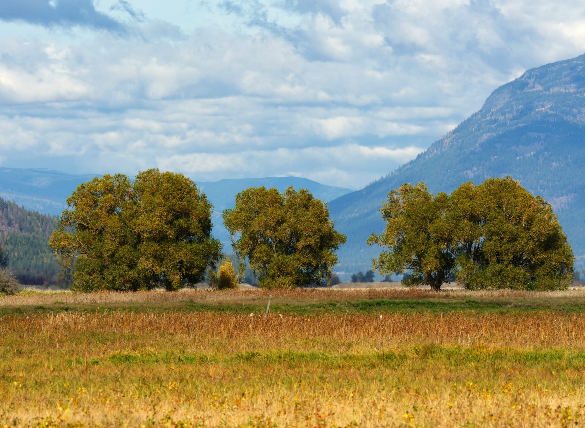
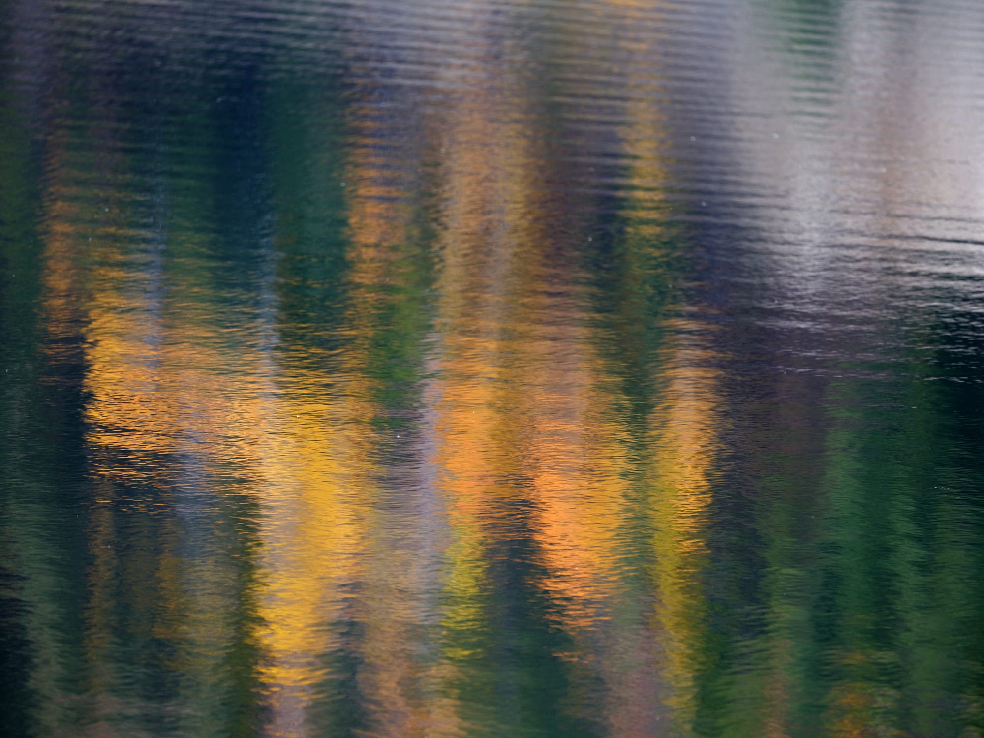
We walked the tightly packed gravel road through cottonwood, paper birch, and poplar trees. Their leaves ranged from lemon to mustard to egg-yolk yellow, forming a canopy and tunnel of color this fall afternoon. The air smelled of rotting leaf mold and wet ground—a soft, sweet scent of the deciduous forest.
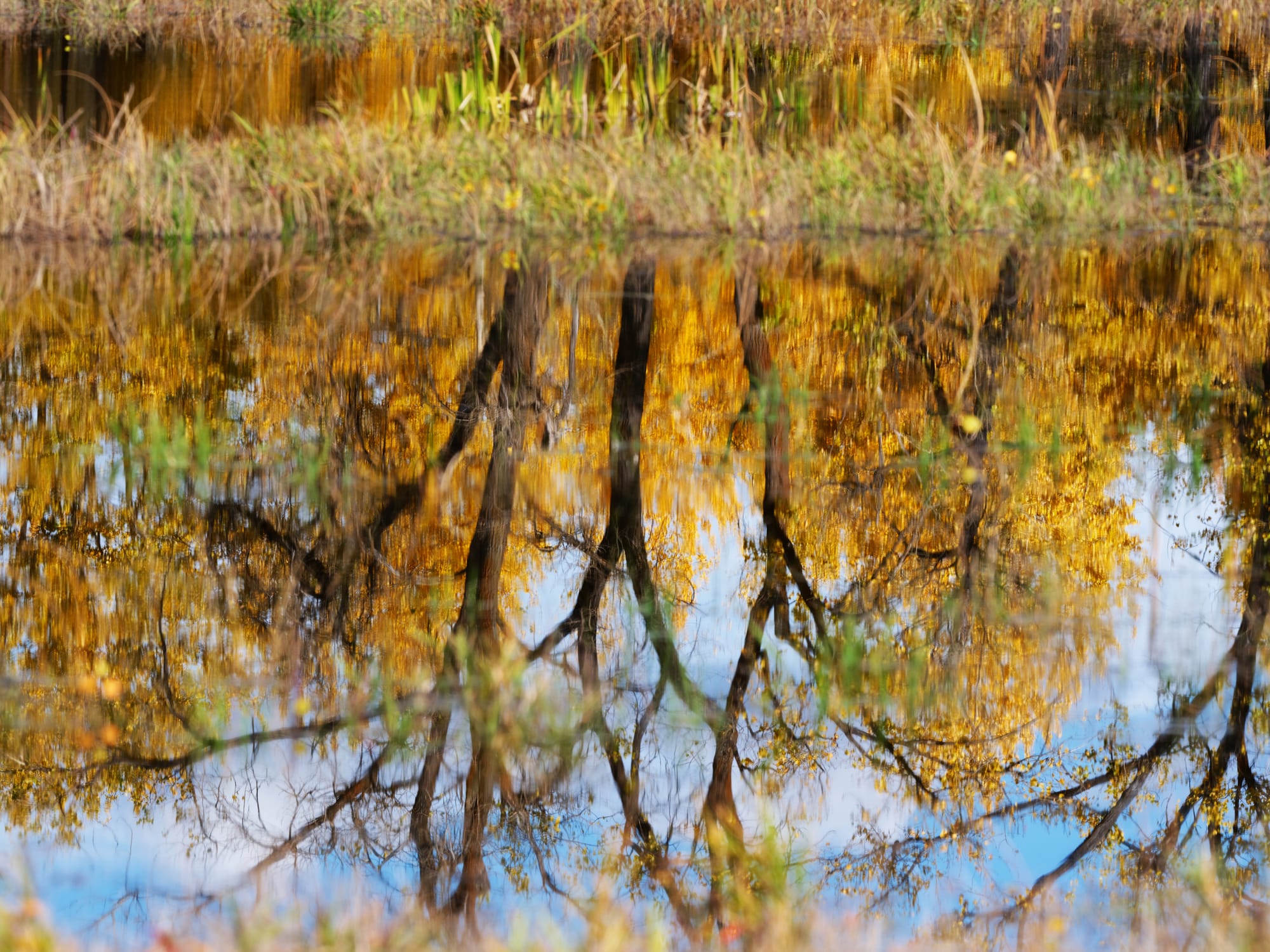
The road was actually a dike, constructed by humans to hold back, on one side, a marshy lake populated by noisy groups of Canada geese and interspersed with flotillas of mallards. The geese, as they will, erupted into fits of honking laughter as some flapped their wings in noisy displays. Others were tilted ass-up, their long necks reaching to the bottom to find aquatic insects in the muddy depths. The pond was irregularly edged with bulrushes and sedges.
On the other side, the dike held back Deep Creek and directed its course to flow into the Kootenai River a couple of miles from us. The creek runs shallowly through a deep ravine over sandy alluvial soil. Constructed between 1925 and the 1960s, the dike was part of the effort to drain this part of the Kootenai River Valley, called the Purcell Trench—fashioned by glaciers during the last ice age.
The dike excluded the flow of Deep Creek, which recruited the waters of streams off the Selkirks to the south of us, from a historically vast bottomland of cottonwoods, bulrushes, sedges, and willows. Thus diverted, the bottomlands could be drained.
On the western edge, a similar dike collected the flows of Cascade and Myrtle Creeks and diverted them to the Kootenai River. Indeed, all the way north to the Canadian border, creeks and streams originating high in the Selkirk Mountains are channeled in a straight line directly to the Kootenai River, transforming the bottomlands into large sections of farmland.
At the bottom of the bank along the creek’s edge stood an enormous electric pump with a huge impeller driven into the creek, surrounded by a fish screen that was broken down in places. This led to a ten-inch diameter pipe that connected to a deflated black rubber hose of the same dimension, running to the top of the dike. This was—now or in the recent past, I could not ascertain—how Deep Creek would flood the swampy bottomlands, at least whenever the pump was switched on.
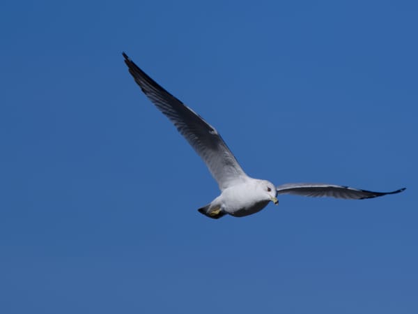
Walking the serpentine dike top is something like walking the serpent mounds of the prehistoric Mississippi culture. We continued along the winding dike and heard the taunting chatter of a Belted Kingfisher as it flashed upstream. This bird has been a good-hearted nemesis—ever-present on Northwest rivers and lakes. It has eluded my attempts at a decent photograph. Though it has dived and flown right in front of me, the bird is shy and moves quickly.
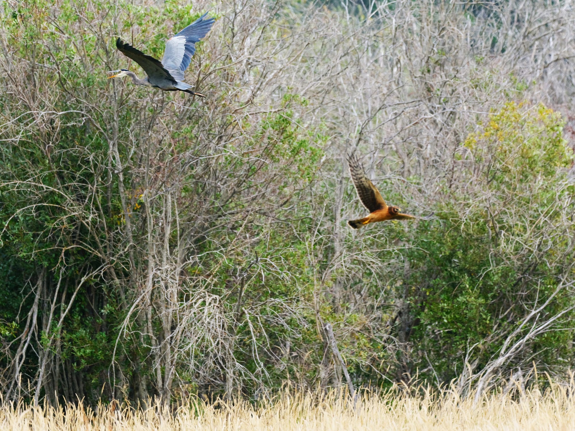
We descended through sparse Ponderosa Pines onto the mown grass of the bottoms. Here we found a dry path back to the road and eventually to the truck. Late summer, this was near where I flushed a heron and a Northern Harrier at the same time. Today, the area is calmer. Though clouds are all about, it remains sunny and warm—for now.
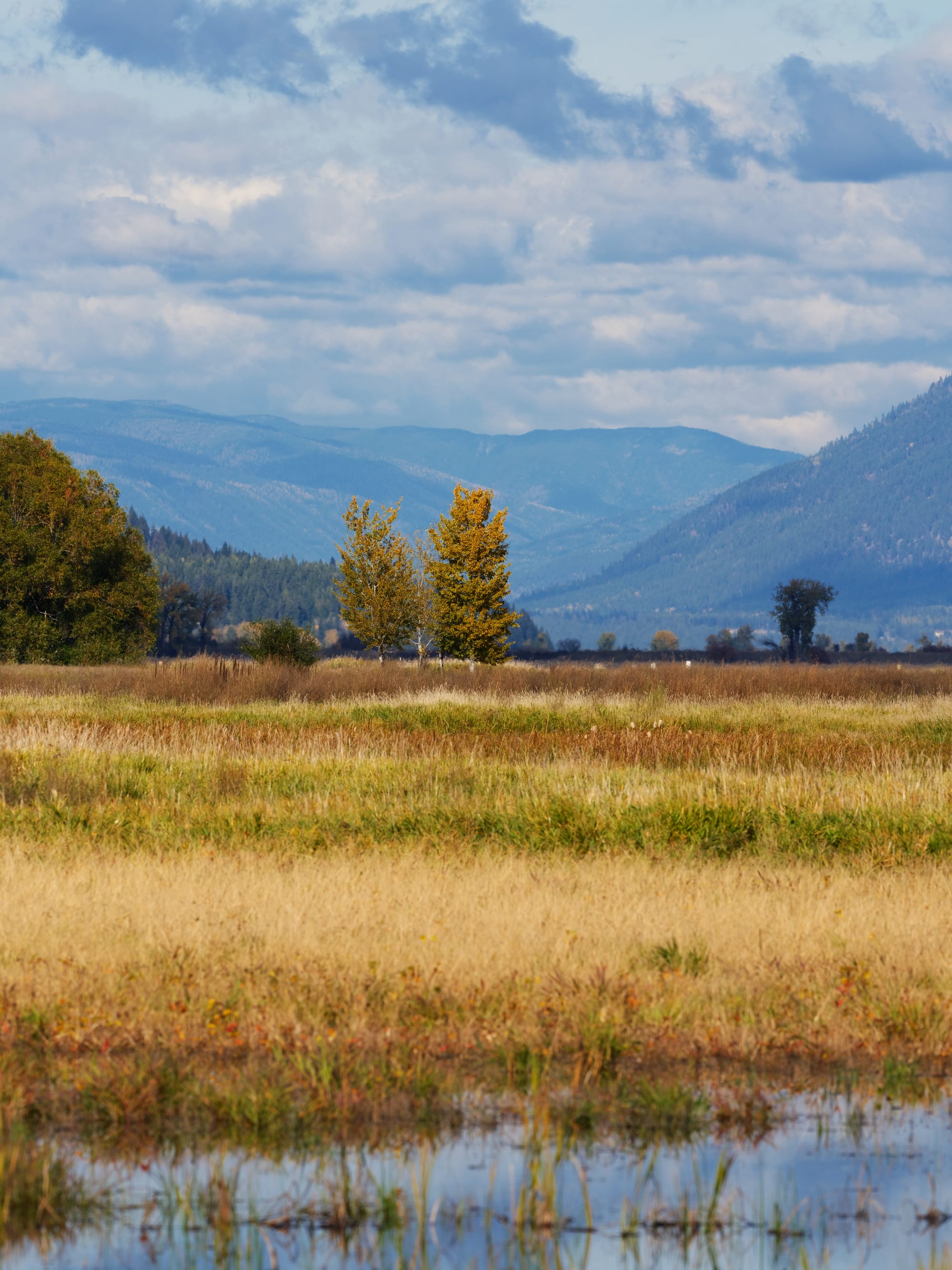
Beneath the heavy grass lay moist, muddy soil—the water table so close to the surface. Water flanked us on either side, and we were bothered by the occasional mosquito. They still asserted themselves despite the season. A lone duck swam away from us, and again we heard the Kingfisher, its chittering call insistently echoing from the Ponderosa Pines we had just passed through. White flashes marked its frantic flight back and forth in front of the trees—an uncertain display that only reinforced my sense of being taunted. We carried on as I grumbled lightheartedly.
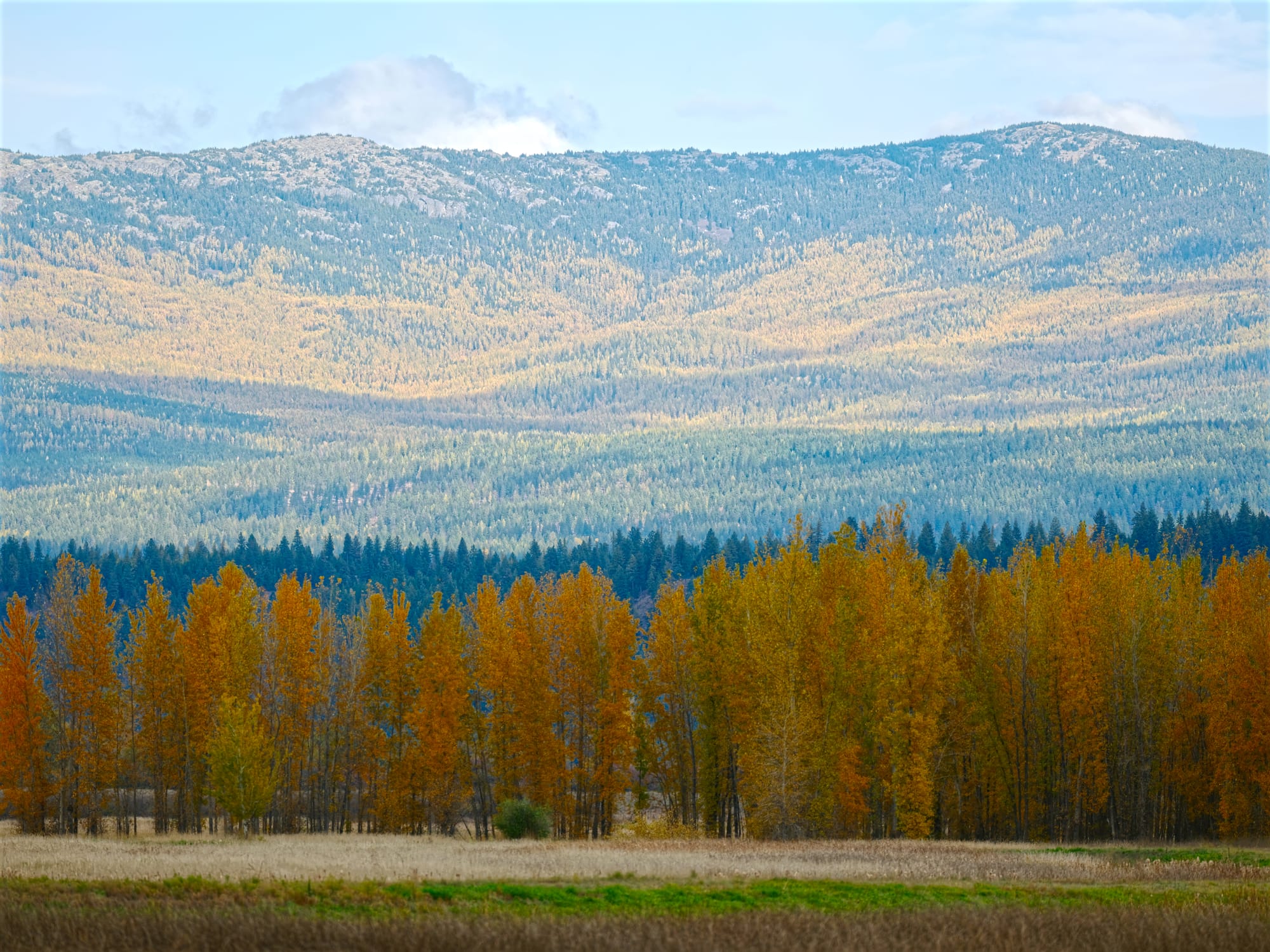
We could see north down the Purcell Trench, which cradles the Kootenai and this wide, flat valley well into Canada. The Selkirk Mountains extended on my left and the Purcell Mountains on my right.
These swampy bottomlands are part of the Kootenai National Wildlife Refuge (NWR)—3,700 acres carved out of farmland that was itself created from the original Kootenai River Valley. The refuge’s mission is to restore this drained farmland to something like its original state, so it can support more of the dwindling populations of migratory waterfowl. Not unexpectedly, it’s now literally an uphill battle. Water that once flowed naturally across the flat bottomland is now carved and channeled below the level of the land to reach the river and drain the rich alluvial soils. Water must now be moved to recreate the wetlands. Farmers now plant crops meant only to be harvested by birds.
Currently, the refuge is in the midst of an ambitious project funded by the Bonneville Power Administration and co-sponsored by the Kootenai Indian Tribe of Idaho to restore historical flood flows to the wetlands. This involves raising roads to accommodate higher flood levels and breaching dikes to enable seasonal flooding of the reserve. The plan will significantly change the nature of the place and make it less accessible to people during parts of the year. It does not anticipate the complete removal of all dikes and earthworks, nor will it restore historical stream flows. Still, it is expected to attract and support much more wildlife and increase populations of endangered fish like burbot and sturgeon.
As we walked across the valley bottom, again we were interrupted by the chittering taunt of the Kingfisher as it winged past us low to the ground and over the water on our left. We stopped to watch its progress, which, if true to form, would end with it disappearing into the tall trees beside the far road.
Alas, it landed on a post at the water’s edge, and I raised my camera to get a few distant photos. We walked cautiously forward as I stopped to take more, getting closer and closer. Mollie ran about, doing her best to keep wildlife away from us.
Eventually, the Kingfisher grew nervous and cried as it flitted to another, more distant post. It was being generous with its presence. A couple more photographs, and it dove close to the ground, streaking along the shoreline on our right before rising over the reeds and disappearing into the bulrushes.
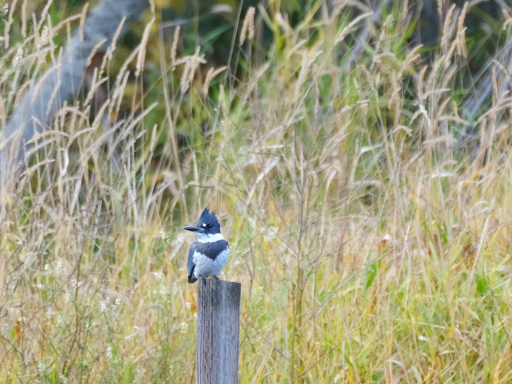
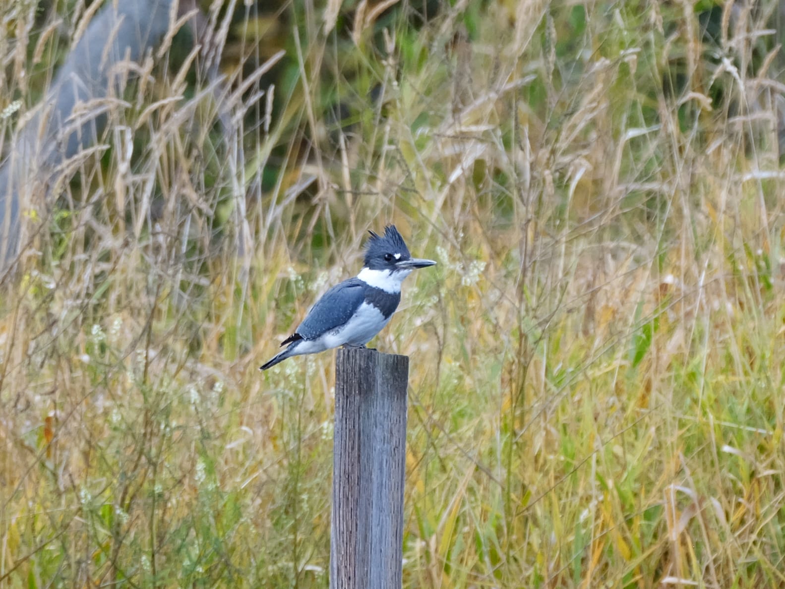
Banded Kingfisher. (looking very punk I think)
I was pleased—I had a few images better than any I’d managed in the past.
We found an old path that ran below and parallel to the road, leading us back to the parked car. We bushwhacked further until we surrendered and climbed the steep bank to the level of the dirt road, wandering back to the truck. By now, clouds had moved up from the south and closed out the last remaining sunlight. A light rain tapped on the windscreen.
The Kootenai NWR has an auto-tour route that was closed for construction a couple of months ago when I was last here. We drove past the headquarters today to find the route now open and proceeded to drive the high dike road along Myrtle Creek and the new sections across the refuge toward the Kootenai shore dike. Most of the area looked like a subdivision was being put in—large areas scraped and reshaped, trees grubbed up and stacked. The landscape reformed. There wasn’t much to see.
We drove into Bonners Ferry’s small, old downtown and visited Bonners Books, then had a late lunch at Under the Sun across the street. That completed a simple day out: hiking, lunch, and some books to read.